
Walk a Chandler Street
A Chandler street is a row of parcels, not a roster of all people indoors. The public trail begins with a precise address in the Maricopa County Assessor Property Search. Its parcel card supplies the current owner, assessor parcel number, property address, tax mailing address, legal description, subdivision, map reference, and current deed number. Those fields create stable links to the map and recorded instruments. They also prevent a loose name match from becoming a false claim about residence.
- Enter the address in the Assessor search. Open the matching parcel and save its APN, property address, mailing address, legal description, MCR map reference, owner, and deed number.
- Open the Parcel Viewer. Select the parcel polygon, then click the lots along the same street one at a time to build an owner and parcel inventory.
- Follow each deed number to the Recorder. Read the named grantor and grantee, date, document type, and legal description rather than relying on a street label alone.
- Use Chandler permit and planning records to date work at each address. Treat applicants and contractors as project parties, not as residents.
- For an older household, switch to a street or criss-cross section in a dated directory, then confirm the printed person in its alphabetical section.
The process moves from address to parcel, parcel to owner, owner to deed, and deed to a dated transfer. A voter record may add lawful registration evidence, but Arizona does not offer a casual browse of every voter by street.
Search Chandler Streets Precisely
The Maricopa County Assessor Property Search accepts more than a street address. It can infer whether a query is an APN, owner, address, subdivision, or MCR map number. Address entries use the number, direction, street name, and abbreviated type. City and ZIP are optional. If a full query fails, remove punctuation or the street type before concluding that the parcel is absent.
The official Assessor screen shows how Chandler address records begin:
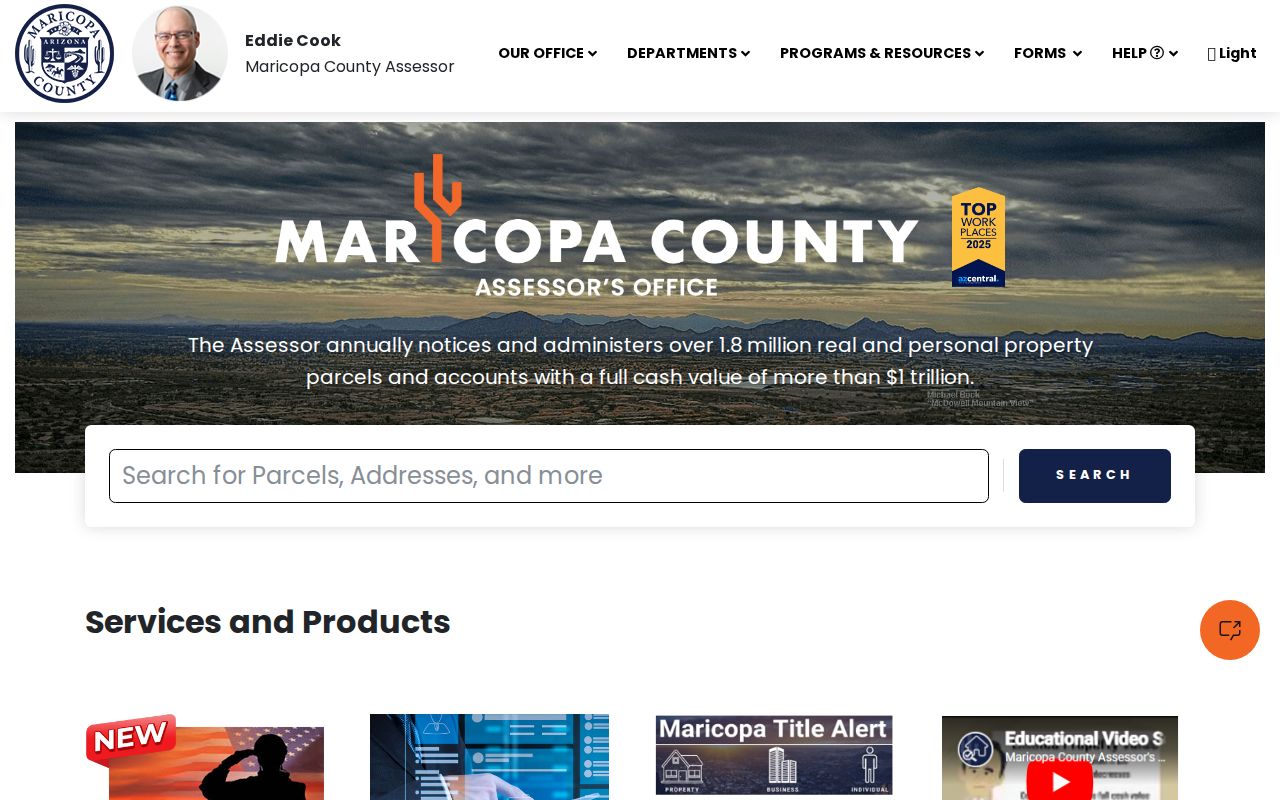
The result is a tax record for land. It is not a live list of every person at the address.
| Assessor field | Input | Required | Chandler search note |
|---|---|---|---|
| Search | Text or autocomplete | Yes | Infers APN, owner, address, subdivision, or MCR |
| Parcel Number | Text | Optional | Accepts dashed or undashed APN |
| Owner Name | Text | Optional | Use the full first name, not an abbreviation |
| Address | Text | Optional | Direction and street type may be abbreviated; city and ZIP are optional |
| Subdivision | Text | Optional | Can open all parcels in a named subdivision |
| MCR Number | Text | Optional | Opens parcels shown on the recorded map |
The Assessor search help illustrates the accepted forms and query choices:
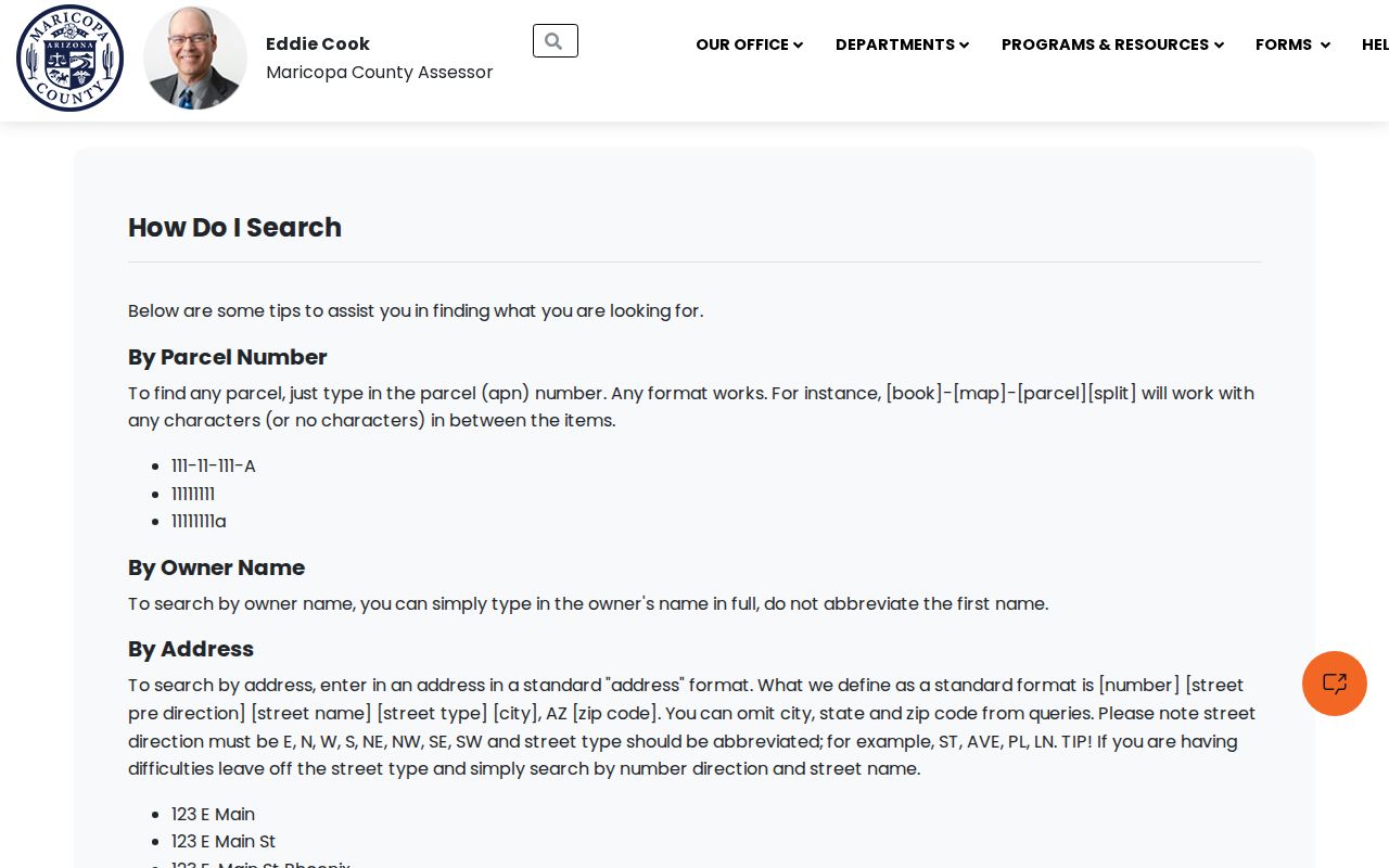
Those formats are useful when a direction, suffix, or optional postal field blocks an otherwise valid match.
Chandler Street Mailing Clues
The property address, also called the situs address, locates the land. The mailing address is where the county sends the tax notice. A remote mailing address may fit an owner who lives elsewhere, a trust, a business office, or a simple mailing preference. Matching addresses support owner-occupancy as a possibility, but still do not name relatives or other household members.
This distinction is an essential Chandler street directory check. Record both values with the tax year shown on the parcel card. Then compare the current deed and any other dated source. Never turn one mailing field into an unsupported statement that a named person lives on the street.
- Parcel
- A legally assessed piece of land identified by an assessor parcel number.
- Situs address
- The physical property address, which may differ from the owner's mailing destination.
- Plat
- A recorded map that divides land into lots, blocks, streets, and easements.
- Criss-cross directory
- A historical directory arranged by street and house number rather than only by surname.
Chandler Records Linked by Address
No one index answers every street question. The Assessor establishes current tax-roll facts. Parcel Viewer adds space and adjoining lots. The Recorder supplies transfer instruments. Chandler maps resolve jurisdiction, while permits describe work. Historical directories can identify an occupant in one published year. Voter data has a narrower, law-bound role.
| Address source | Official keeper | Evidence returned | Access route |
|---|---|---|---|
| Property roll | Maricopa County Assessor | APN, owner, property and mailing addresses, deed and MCR links | Free web search |
| Parcel map | Maricopa County Assessor | Lot shapes, adjoining parcels, owner and address panel | Free interactive viewer |
| Deeds and plats | Maricopa County Recorder | Named parties, dates, document type, legal description, image | Free index and unofficial image; official copies cost extra |
| City maps and permits | Chandler Development Services | City limits, address blocks, private streets, project history | Maps, department tools, or city records request |
| Voter material | Maricopa County Elections | Permitted registration and election-history fields | Individual verification or controlled records request |
| Historic directories | Arizona Memory Project and local repositories | Dated occupants and, when present, street-order listings | Digitized volume, catalog, or repository help |
The APN, MCR, deed number, and legal description do most of the joining. Street spellings can shift, but those land identifiers preserve the link.
Browse Chandler Street Parcels
In the Maricopa County Assessor Parcel Viewer, search an address or intersection and select an autocomplete result. The map zooms to the point. Click the polygon beneath it to expose the APN, owner, property address, and mailing address. Then select bordering polygons one by one. Aerial and base-map views help keep lot lines distinct.
Parcel browsing is a sound way to build a by-street owner inventory. It does not establish who occupies each home. ZIP, subdivision, section-township-range, map ID, owner, and APN deep links can broaden or repeat a search. Clear an old result before moving to another block so details from two parcels are not mixed.
Note: Save the parcel number and tax year with every result because ownership and valuation screens are dated snapshots.
Build Chandler Street Deeds
The Recorder index is built around names and documents, not a dependable modern street query. Start with the Assessor deed number and owner. In the Recorded Document Search, search a natural person by last and first name. Trusts, companies, homeowners associations, and subdivisions belong under Business Name. Add a recording-date band to reduce false matches.
A Recorder result may show the recording number and date, document code, grantors, grantees, page count, and a colored Pages link to an unofficial image. The deed itself can reveal the legal description, APN, return address, and affidavit references. Match the lot or legal description for every parcel. One person may own several properties, so name alone is weak proof.
The Recorder's deed and plat guidance explains the index and copy route:
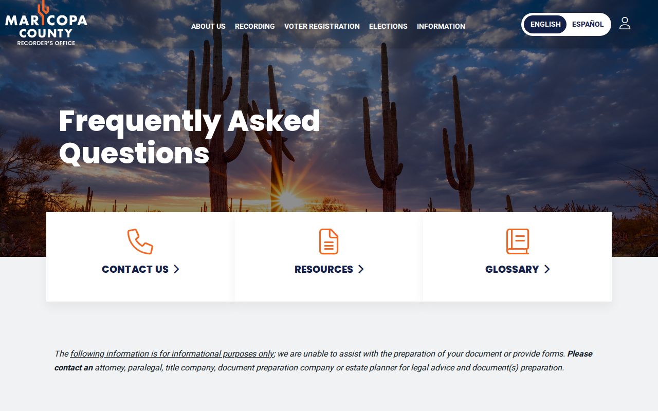
Unofficial images can be viewed without charge. Official copies cost $1 per page, and certification adds $3 per document.
Millions of Chandler Deed Clues
The Maricopa County Recorder reports preserving more than 52 million documents. That scale matters for a Chandler street search. A common owner name can lead to many unrelated deeds, liens, releases, plats, and notices. Date limits, document type, parcel facts, and the exact legal description help isolate the right instrument.
Web access is only one channel. The Recorder's main office is at 301 W. Jefferson Street, second floor, Suite 200, in Phoenix. It is open Monday through Friday from 8 a.m. to 5 p.m.; the phone is 602-506-3535. Free inspection is by appointment. If an old book or image is missing online, ask about inspection rather than inventing an index cutoff. Recorder staff records instruments but does not conduct title research or decide legal validity.
Two Chandler Street Grids
Chandler publishes both a Chandler Address Block Number map and a County Address Block Number map. The two-map setup is a local warning: an address may be described under a city grid, a county grid, a postal label, and a recorded legal description. Annexation may shift government jurisdiction without changing the postal city or the land description.
The official Chandler maps also include city limits, ZIP areas, township-range-section references, and a GIS map book. InfoMap can flag privately owned streets. Such a street can help explain why a city maintenance or permit trail looks different. For exact property identity, return to the APN, subdivision, MCR map, and lot or block description.
Chandler Street Permits Add Dates
Development Services keeps building, site, encroachment, engineering, GIS, planning, and related records. An address-keyed permit can date construction or an alteration and may name an owner, applicant, contractor, and project address. Those are roles in a project file. They do not prove that any named party occupied the property.
When the online project trail is incomplete, use the Chandler public-record request route. A useful request names the exact situs address, APN if known, record type, and date range. The city routes requests by department and may review or redact sensitive material.
The city request screen is the documented fallback for Chandler street and permit evidence:
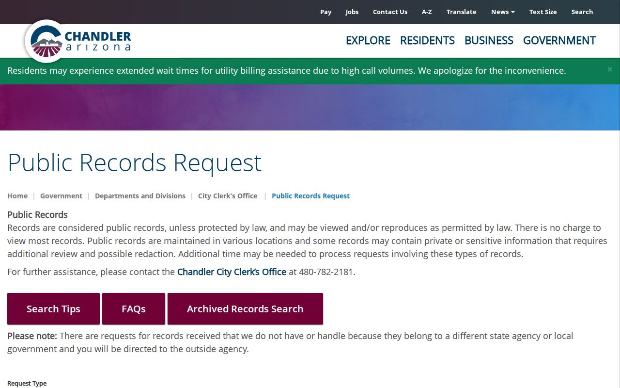
This route is more precise than asking for every record tied to an owner name.
Read Historic Chandler Streets
A reverse or criss-cross section changes the question from “Where did this person live?” to “Who was printed at this house number?” Chandler is verified in a combined Mesa, Tempe, and Chandler directory from 1955 and a Chandler volume from 1958. Search the street heading and house number if that section exists, then use the alphabetical listing to check spelling, spouse, work, employer, and abbreviations.
The old entry is a dated clue, not a permanent residence fact. Published directories can omit people, use initials, or preserve an old street label. Chandler may also be buried under a combined East Valley or Phoenix metropolitan title. Detailed collection research belongs in the Chandler city directory, while the street directory uses a historic volume only to connect one address with one edition.
Chandler Voters Are Not a Street List
ServiceArizona verifies one person's registration. It is not an open browse-by-street directory. Maricopa County handles requests for individual history or controlled VM51 and VM55 files. An individual request needs a full name, birth date, and last known address. Larger files require a stated district, status or election, requester details, and a lawful purpose under A.R.S. § 16-168.
Releasable fields can include a name, registration date, residence and mailing addresses, ZIP, party, precinct, status, and voting participation. Participation never reveals ballot choices. Month and day of birth, government identification numbers, signature, email, and other protected data are withheld. Records sealed under § 16-153 do not appear. Unauthorized reposting or transfer can be a felony.
Note: For ordinary block curiosity, public parcel records are the proper source; Arizona voter files carry use and redistribution limits.
Limits of Chandler Street Records
A Chandler street directory assembled from public sources cannot name everyone inside a building. Property records center on owners and parcels. Deeds show transfer parties. Permits show project roles. Historical directories are snapshots. Utility customers, delivery records, household-member data, and motor-vehicle addresses are not a general public household roll. Protected voter addresses and participants in Arizona's Address Confidentiality Program are deliberately shielded.
Use two compatible facts before connecting a person with an address, and label the date and source. A parcel owner may be a trust or business. An equal situs and mailing address is still not proof of a complete household. A missing web hit may point to a spelling issue, restricted record, older book, or counter-only file.
Lawful personal use. Chandler address records support family history, property research, civic review, and personal safety. Never use them to stalk, harass, threaten, or harm anyone.