
Map Chandler ZIP Coverage
Six delivery ZIPs form the core Chandler postal set, while two more serve PO boxes or specialized mail use. The descriptions below are working geographic summaries from the city's official map and local research. They are not legal boundaries. Exact post-office station names and the dates of past ZIP splits were not confirmed in the official material, so no unsupported station label or realignment year is assigned.
| ZIP | Chandler area | Postal use | Boundary note |
|---|---|---|---|
| 85224 | Northwest and west Chandler | Delivery | Near Tempe and Gilbert edges; confirm city limit parcel by parcel |
| 85225 | Central and north Chandler, including historic downtown | Delivery | Principal central area |
| 85226 | West and southwest Chandler | Delivery | Irregular city edge near I-10 and major commercial corridors |
| 85248 | South Chandler and Ocotillo area | Delivery | Postal geography nears the county line |
| 85249 | Southeast Chandler | Delivery | Near Gilbert and Queen Creek planning geography |
| 85286 | Newer central and south Chandler | Delivery | Growth-era area around Loop 202 |
| 85244 | Chandler mailboxes | PO boxes | Not a residential situs search unit |
| 85246 | Chandler postal use | PO boxes or unique use | Verify the specific mailpiece with USPS |
Delivery ZIPs can cross a city edge. The two PO-box or special-use entries need even more care because neither describes the physical location of a home.
Chandler ZIP Maps Set Context
The Chandler City Maps collection provides separate ZIP and city-limit maps, plus Chandler and county address-block maps, township-range-section references, and a GIS map book. Together they show why one postal label cannot answer a city-records question.
The official map screen is the geographic starting point for the Chandler ZIP code directory:
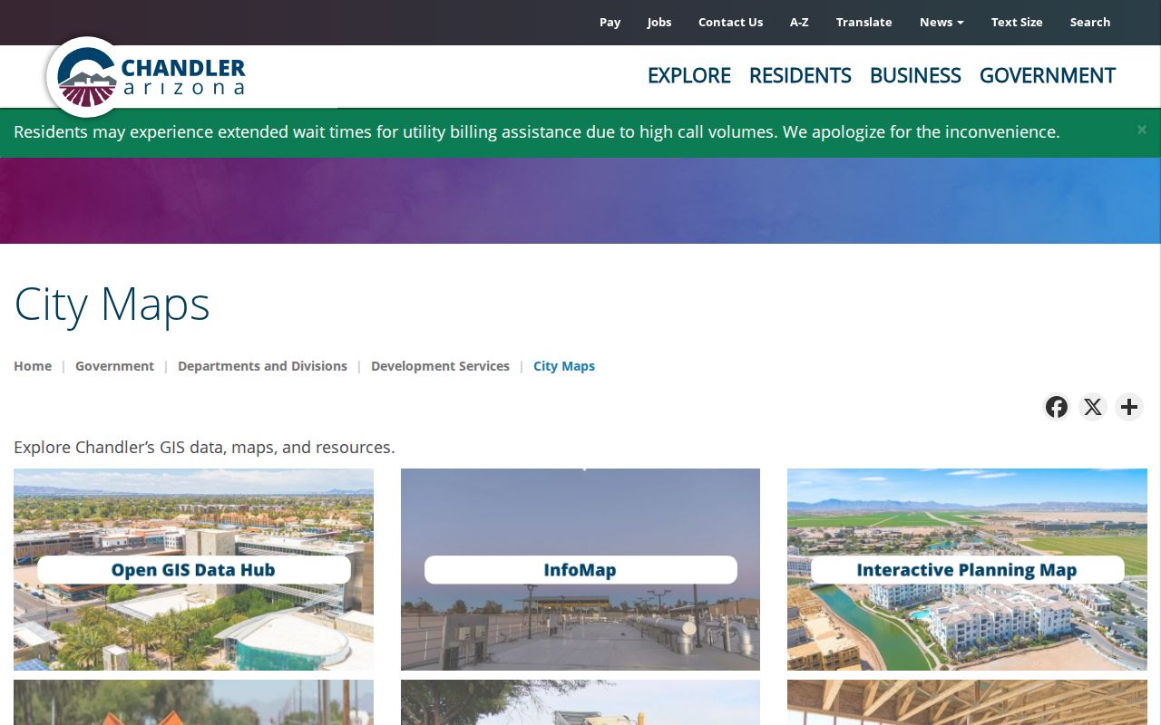
Use the ZIP shape for search scope and the city-limit shape for municipal jurisdiction. When the question involves land, the parcel remains the final local unit.
Chandler ZIPs Versus City Limits
Chandler occupies about 65 square miles in the Southeast Valley. Its edges meet other cities, tribal community land, unincorporated areas, and geography toward Pinal County. Mail delivery was not designed to mirror those government lines. As a result, a mailing address that says Chandler does not by itself prove that Chandler departments hold its permits, code files, or local court material.
Use three separate tests. USPS answers whether a city and ZIP combination works for one delivery address. The Chandler city-limit map answers whether the land is incorporated into the city. The Maricopa County Assessor answers which parcel and APN match the site. That distinction also prevents a nearby postal area from being treated as a Chandler voter precinct or neighborhood boundary.
Boundary rule. A Chandler postal name is delivery evidence, not proof of city jurisdiction, parcel identity, neighborhood membership, or current residence.
Search Chandler Residents by ZIP
A ZIP-wide search should narrow the field before a person or property is verified. Parcel Viewer has a documented ZIP deep-link mode. The ordinary Assessor address query also accepts a ZIP, though it does not promise a complete downloadable list of every owner in that postal area. ServiceArizona checks one person's registration and is not a public ZIP roster.
- Confirm the postal code for the specific delivery address with the official USPS ZIP lookup.
- Compare that address with Chandler's ZIP and city-limit maps. Keep postal coverage separate from city jurisdiction.
- Open the Assessor Parcel Viewer ZIP layer, zoom to the relevant part of the area, and select a parcel polygon.
- Save the APN, property address, owner, and mailing address, then confirm the current deed if ownership matters.
- If the goal becomes a named street, continue with the Chandler street directory and inspect parcels one by one.
A result should be labeled as parcel, ownership, mailing, or registration evidence. None of those fields alone is a complete household list.
Use Chandler Parcel ZIP Tools
The Parcel Viewer ZIP layer can open a ZIP context directly. From there, selecting a parcel reveals its APN, owner name, property address, and mailing address. The map also accepts address or intersection autocomplete, parcel number, owner, subdivision, section-township-range, and other deep links.
The official location help demonstrates how a point becomes a selected parcel:
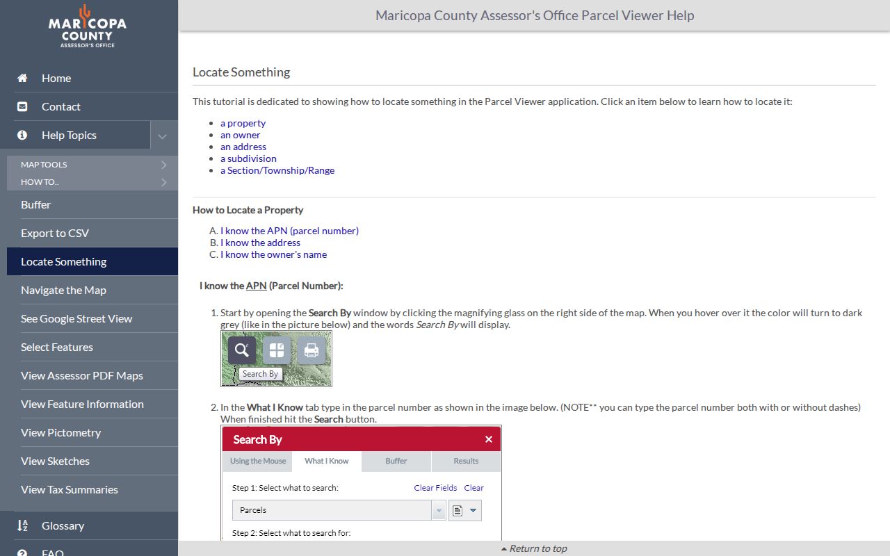
After the map zooms, click the polygon beneath the point. This step keeps the ZIP search tied to actual land instead of a broad postal assumption.
| Viewer search mode | Input | Result use |
|---|---|---|
| ZIP deep link | Five-digit ZIP | Opens postal-area context for parcel browsing |
| Address or Intersection | Autocomplete text | Zooms toward a specific site or crossing |
| Parcel Number | Dashed or undashed APN | Selects known land directly |
| Parcel Owner Name | Surname and optional given name | Finds possible owner parcels |
| Subdivision or MCR | Name or recorded map number | Opens a group of platted parcels |
Three Chandler Address Identities
Every parcel can carry several address clues. The situs address locates the land. The mailing address tells where the tax notice goes. The legal description identifies the lot, block, and subdivision without depending on a street name. An APN, or assessor parcel number, is the county's assessed-land key and may include a split suffix.
A move, trust, postal change, or tax-mail preference can separate these fields. Annexation can change jurisdiction while the postal city stays the same. The subdivision or MCR map link connects the street label to a recorded plat. For that reason, the legal description and APN are stronger bridges between a ZIP map, a parcel card, and a deed than the printed ZIP alone.
- ZIP code
- A five-digit USPS delivery area, not a city or parcel boundary.
- ZIP+4
- A five-digit ZIP plus four digits that narrow delivery to a segment, building, or group of boxes.
- PO-box ZIP
- A postal code used for boxes rather than residential situs addresses.
- Unique ZIP
- A code assigned for a high-volume organization or specialized postal use.
- Carrier route
- A mail-delivery path within a ZIP, which does not equal a city district.
85225 Anchors Historic Chandler
ZIP 85225 covers central and north Chandler and includes the historic downtown area. That makes it useful for orienting a search around older blocks, but it is still a modern postal frame. Chandler's townsite dates to 1912, and city archive series begin later. Old deeds, plats, and directory entries may predate the current ZIP label or use a different form of the address.
When researching an older central property, start with today's parcel only to recover the APN, subdivision, MCR, and legal description. Then use those stable facts to reach deeds and plats. A historic directory or city archive can add dated people and project clues, but the ZIP should never be projected backward onto a record that did not use it.
South Chandler ZIP Growth
ZIP 85248 frames Ocotillo and southern neighborhoods. ZIP 85249 covers southeast Chandler near Gilbert and Queen Creek planning geography. ZIP 85286 reflects newer central and south growth near Loop 202. These descriptions help choose where to zoom. They do not promise that every address within the postal shape belongs to the city.
Growth also creates records from different eras. A newer parcel may have clear online assessment, plat, deed, and permit links, while an older central site may require more archival work. No official split or realignment date was found for these ZIPs in the source material. Preserving that gap is better than attaching a guessed year to Chandler's development story.
Note: Use current official maps for exact edges because postal service and municipal boundaries can change on different schedules.
Chandler PO-Box ZIP Limits
ZIP 85244 is associated with Chandler PO boxes. ZIP 85246 has PO-box or unique postal use that should be checked for each mailpiece. A box can receive mail for a person or organization located elsewhere, so it is not a residential situs search unit. Do not plot it as if it were a neighborhood or infer that its holder lives in Chandler.
For a box address, USPS can validate the postal form. A public entity filing or other official source may connect the box to a dated contact record, but that remains a mailing clue. If the aim is land or city jurisdiction, find a physical address from an appropriate public record and verify it against the Assessor and city-limit map.
Chandler ZIP Voter Boundaries
Voting precincts and ZIP areas answer different questions. ServiceArizona provides individualized registration verification. Maricopa County's VM51 and VM55 voter-file routes are controlled by A.R.S. § 16-168, require requester and scope details, exclude protected voters, and restrict purpose and redistribution. They are not a public tool for downloading every person in one Chandler ZIP out of curiosity.
Where lawfully obtained, voter material can contain address, ZIP, precinct, district, party, status, and participation history. It never shows ballot choices. Sensitive identifiers, signature, email, and protected rows are withheld. For general geographic research, the ZIP map and parcel layer are the safer open channels. For one person's status, use the official verification path with the required identity facts.
Verify Chandler ZIP Findings
The Chandler ZIP code directory narrows a large city into postal zones, but its output remains a lead. Check delivery with USPS, jurisdiction with Chandler's city-limit map, and land identity with the Assessor. If a parcel owner matters, compare the current deed and effective tax year. If a person matters, seek an independent dated record rather than treating an owner or mailing addressee as a resident.
Online maps can also fail or lag. City Development Services can clarify map and planning data, while a focused Arizona public-record request can seek a defined city record by address and date. The county Assessor and Recorder remain separate custodians for parcels and deeds. Keeping each office's role distinct prevents a ZIP clue from becoming a false identity claim.